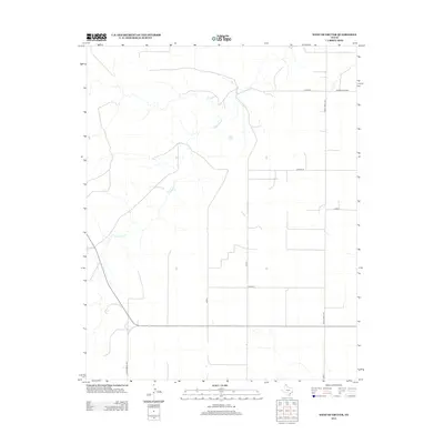
2012 Map of West of Gruver
USGS Topo · Published 2012About this map
Coldwater Cr meanders across this high plains landscape in Sherman County, defining the drainage patterns of an otherwise largely grid-based agricultural region. The persistence of water in this semi-arid environment is highlighted by Martin Springs, a critical landmark for local geography and hydrology. The road network follows a strict rectilinear survey pattern characteristic of the Texas Panhandle, dominated by secondary routes such as Co Road K and Co Road M. Major thoroughfares like Ranch Road 1573 and Ranch Road 1262 provide the primary connectivity for the ranching and farming operations that define the area's economy. This survey captures the rural infrastructure as it stood in the early 21st century, showing the precise alignment of local county roads and ranch-to-market access points.
Find a feature on this map
12 named features on this map. Tap any name to fly to it.
Don’t see what you’re looking for? This feature index may not catch every label — zoom into the map to look around manually.
Map Details
Editions of this 2012 West of Gruver Map
This is the sole edition of this map. No revisions or reprints were ever made.
Other maps of this area

1954 · Perryton
USGS Topo · 1:250,000

1958 · Perryton
USGS Topo · 1:250,000

1973 · Gruver
USGS Topo · 1:24,000

1974 · Sunray 1 NW
USGS Topo · 1:24,000

1974 · Hannas Draw East
USGS Topo · 1:24,000

1974 · Sunray 1 SW
USGS Topo · 1:24,000

1974 · Sunray 1 SE
USGS Topo · 1:24,000

1974 · Capps Switch NW
USGS Topo · 1:24,000

1974 · Hannas Draw West
USGS Topo · 1:24,000

1974 · Sunray 1 NE
USGS Topo · 1:24,000