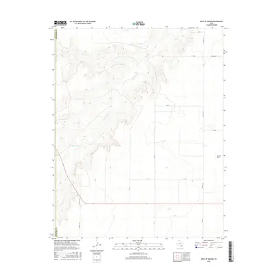
2016 Map of West of Gruver
USGS Topo · Published 2016About this map
Coldwater Cr winds through the high plains of the Texas Panhandle, carving a distinct drainage pattern across this portion of Sherman County. The landscape is defined by the sharp contrast between the flat, gridded agricultural tablelands and the eroded breaks surrounding Martin Springs and the headwaters of Farwell Draw. This 2016 survey illustrates a modern rural economy built on a network of straight-line section roads, including Farm Rd 1262 and Farm Rd 2535, which facilitate movement between scattered homesteads and larger regional hubs. The intersection of Ranch Rd 1573 and Farm Rd 1573 near the western boundary highlights the transition from traditional ranching lands to intensive agricultural use, capturing the spatial organization of the modern cattle and grain country just before the Hansford County line.
Find a feature on this map
16 named features on this map. Tap any name to fly to it.
Don’t see what you’re looking for? This feature index may not catch every label — zoom into the map to look around manually.
Map Details
Editions of this 2016 West of Gruver Map
This is the sole edition of this map. No revisions or reprints were ever made.
Other maps of this area

1954 · Perryton
USGS Topo · 1:250,000

1958 · Perryton
USGS Topo · 1:250,000

1973 · Gruver
USGS Topo · 1:24,000

1974 · Sunray 1 NW
USGS Topo · 1:24,000

1974 · Hannas Draw East
USGS Topo · 1:24,000

1974 · Sunray 1 SW
USGS Topo · 1:24,000

1974 · Sunray 1 SE
USGS Topo · 1:24,000

1974 · Capps Switch NW
USGS Topo · 1:24,000

1974 · Hannas Draw West
USGS Topo · 1:24,000

1974 · Sunray 1 NE
USGS Topo · 1:24,000