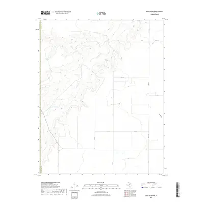
2019 Map of West of Gruver
USGS Topo · Published 2019About this map
Coldwater Cr carves a winding path across the northern half of this landscape, creating a distinct topographical contrast to the surrounding high plains of the Texas Panhandle. This 2019 survey documents the sparsely populated border region between Sherman and Hansford counties. Water remains the primary shaper of the terrain here, evidenced by the presence of Martin Springs and the eastern drainage of Farwell Draw. The map illustrates a strictly organized grid of agricultural and access roads, including Farm Rd 1262 and Farm Rd 2535, which serve the expansive ranching and farming operations characteristic of this region. The intersection of Ranch Rd 1573 and Farm Rd 1573 in the southwest corner highlights the specialized transportation network required for modern livestock and grain movement in the rural High Plains.
Find a feature on this map
16 named features on this map. Tap any name to fly to it.
Don’t see what you’re looking for? This feature index may not catch every label — zoom into the map to look around manually.
Map Details
Editions of this 2019 West of Gruver Map
This is the sole edition of this map. No revisions or reprints were ever made.
Other maps of this area

1954 · Perryton
USGS Topo · 1:250,000

1958 · Perryton
USGS Topo · 1:250,000

1973 · Gruver
USGS Topo · 1:24,000

1974 · Sunray 1 NW
USGS Topo · 1:24,000

1974 · Hannas Draw East
USGS Topo · 1:24,000

1974 · Sunray 1 SW
USGS Topo · 1:24,000

1974 · Sunray 1 SE
USGS Topo · 1:24,000

1974 · Capps Switch NW
USGS Topo · 1:24,000

1974 · Hannas Draw West
USGS Topo · 1:24,000

1974 · Sunray 1 NE
USGS Topo · 1:24,000