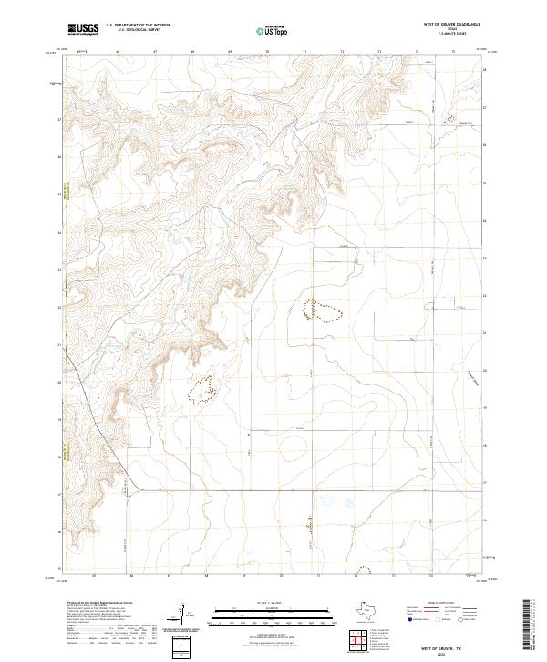
2022 Map of West of Gruver
USGS Topo · Published 2022About this map
Coldwater Cr carves a deep, dendritic drainage system through the High Plains along the border of Sherman and Hansford counties. This landscape is defined by the sharp contrast between the flat upland agricultural plateaus and the complex erosional breaks leading down to the creek bed. Local hydrology is further marked by Martin Springs and the southern reach of Farwell Draw. The road network follows the classic section-line grid of the Texas Panhandle, anchored by Farm Rd 1262 and Ranch Rd 1573. This 2022 survey captures the area's modern rural character, where large-scale ranching and farming operations are dictated by the underlying topography and the availability of water in an otherwise arid environment.
Find a feature on this map
16 named features on this map. Tap any name to fly to it.
Don’t see what you’re looking for? This feature index may not catch every label — zoom into the map to look around manually.
Map Details
Editions of this 2022 West of Gruver Map
This is the sole edition of this map. No revisions or reprints were ever made.
Other maps of this area

1954 · Perryton
USGS Topo · 1:250,000

1958 · Perryton
USGS Topo · 1:250,000

1973 · Gruver
USGS Topo · 1:24,000

1974 · Sunray 1 NW
USGS Topo · 1:24,000

1974 · Hannas Draw East
USGS Topo · 1:24,000

1974 · Sunray 1 SW
USGS Topo · 1:24,000

1974 · Sunray 1 SE
USGS Topo · 1:24,000

1974 · Capps Switch NW
USGS Topo · 1:24,000

1974 · Hannas Draw West
USGS Topo · 1:24,000

1974 · Sunray 1 NE
USGS Topo · 1:24,000