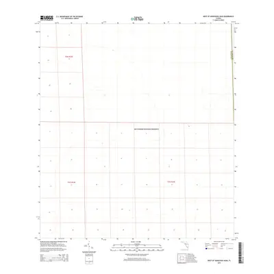
2015 Map of West of Horseshoe Head
USGS Topo · Published 2015About this map
Big Cypress National Preserve dominates this portion of the Florida Everglades, illustrating the sprawling wetland wilderness at the boundary of Collier and Broward counties. This 2015 survey captures a landscape defined almost entirely by its natural hydrology and conservation status, appearing largely devoid of modern road networks or permanent human settlements. The map is primarily organized by the Public Land Survey System, showing sections within townships such as t50s r33e and t51s r34e. This cartographic layout reflects how the vast, flooded interior of the southern peninsula was systematically partitioned into a grid, even where the terrain remained inaccessible to traditional development.
Find a feature on this map
5 named features on this map. Tap any name to fly to it.
Don’t see what you’re looking for? This feature index may not catch every label — zoom into the map to look around manually.
Map Details
Editions of this 2015 West of Horseshoe Head Map
This is the sole edition of this map. No revisions or reprints were ever made.
Other maps of this area

1956 · Miami
USGS Topo · 1:250,000

1956 · West Palm Beach
USGS Topo · 1:250,000

1957 · West Palm Beach
USGS Topo · 1:250,000

1958 · West Palm Beach
USGS Topo · 1:250,000

1958 · Miami
USGS Topo · 1:250,000

1972 · Monroe Station NE
USGS Topo · 1:24,000

1973 · North Of Fiftymile Bend
USGS Topo · 1:24,000

1973 · Everglades 3 NE
USGS Topo · 1:24,000
1973 · North of Fortymile Bend
USGS Topo · 1:24,000
1974 · Everglades 3 SW
USGS Topo · 1:24,000