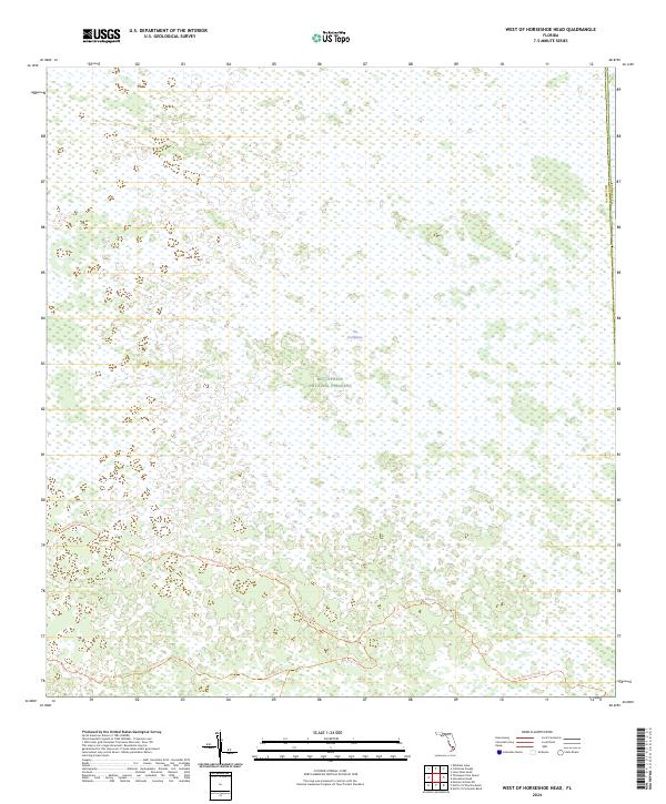
2024 Map of West of Horseshoe Head
USGS Topo · Published 2024About this map
Big Cypress National Preserve dominates this subtropical landscape along the boundary of Collier and Broward Counties. The sheet highlights a vast wetland environment where The Everglades transition through a network of remote backcountry routes. Navigation through this inundated terrain is limited to primitive paths like the Raccoon Point Cdu Trl and North Raccoon Point Trl, which wind through the preserve's southern sections. This modern survey illustrates the preservation of a sensitive ecosystem, largely devoid of permanent settlements or modern road infrastructure, favoring instead the preservation of the natural hydrography and public lands including the winding Lost Dog 1 Trl.
Find a feature on this map
11 named features on this map. Tap any name to fly to it.
Don’t see what you’re looking for? This feature index may not catch every label — zoom into the map to look around manually.
Map Details
Editions of this 2024 West of Horseshoe Head Map
This is the sole edition of this map. No revisions or reprints were ever made.
Other maps of this area

1956 · Miami
USGS Topo · 1:250,000

1956 · West Palm Beach
USGS Topo · 1:250,000

1957 · West Palm Beach
USGS Topo · 1:250,000

1958 · West Palm Beach
USGS Topo · 1:250,000

1958 · Miami
USGS Topo · 1:250,000

1972 · Monroe Station NE
USGS Topo · 1:24,000

1973 · North Of Fiftymile Bend
USGS Topo · 1:24,000

1973 · Everglades 3 NE
USGS Topo · 1:24,000
1973 · North of Fortymile Bend
USGS Topo · 1:24,000
1974 · Everglades 3 SW
USGS Topo · 1:24,000