
1974 Map of West Of Horseshoe Head
USGS Topo · Published 1993About this map
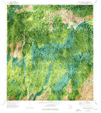
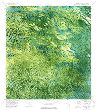
The Miccosukee Indian Reservation dominates this 1974 orthophotomap, showing the intricate natural patterns of the Florida Everglades as they existed in the early 1970s. This specific survey area straddles the boundary between Collier Co and Broward Co, capturing a landscape defined by water and vegetation rather than human development. Unlike traditional line-drawn topographic maps, this orthophotomap uses processed aerial photography to reveal the dense texture of tree islands, sloughs, and sawgrass marshes that characterize the northern reaches of the reservation. The lack of named roads or buildings emphasizes the protected nature of this wilderness area, providing researchers with a visual record of the region's hydrology and land cover before later environmental changes. It serves as a stark look at the Big Cypress and Everglades interior during a period of transition in Florida conservation history.
Find a feature on this map
2 named features on this map. Tap any name to fly to it.
Don’t see what you’re looking for? This feature index may not catch every label — zoom into the map to look around manually.
Map Details
Editions of this 1974 West Of Horseshoe Head Map
2 editions found
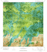
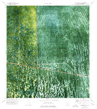
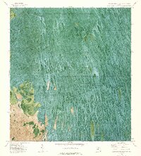
Other maps of this area

1956 · Miami
USGS Topo · 1:250,000

1956 · West Palm Beach
USGS Topo · 1:250,000

1957 · West Palm Beach
USGS Topo · 1:250,000

1958 · West Palm Beach
USGS Topo · 1:250,000

1958 · Miami
USGS Topo · 1:250,000
1972 · Monroe Station NE
USGS Topo · 1:24,000
1973 · North Of Fiftymile Bend
USGS Topo · 1:24,000
1973 · Everglades 3 NE
USGS Topo · 1:24,000
1973 · North of Fortymile Bend
USGS Topo · 1:24,000
1974 · Everglades 3 SW
USGS Topo · 1:24,000