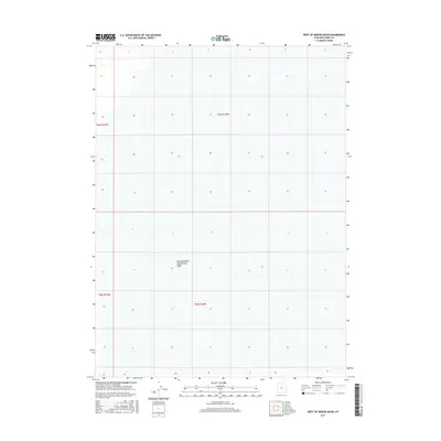
2017 Map of West of Miners Basin
USGS Topo · Published 2017About this map
Newfoundland Evaporation Basin dominates the lower central portion of this area in the western salt flats of Box Elder County. This map documents a largely open and specialized landscape defined by the Public Land Survey System grids of t6n r16w, t6n r15w, t5n r16w, and t5n r15w. The absence of roads or permanent structures reflects the industrial and environmental character of this region, where land use is centered on evaporation processes rather than traditional settlement. For the researcher, this sheet provides the specific legal boundaries and hydrographic markers of this isolated portion of the Great Salt Lake desert as it was mapped in the early twenty-first century.
Find a feature on this map
5 named features on this map. Tap any name to fly to it.
Don’t see what you’re looking for? This feature index may not catch every label — zoom into the map to look around manually.
Map Details
Editions of this 2017 West of Miners Basin Map
This is the sole edition of this map. No revisions or reprints were ever made.
Other maps of this area

1954 · Brigham City
USGS Topo · 1:250,000

1958 · Brigham City
USGS Topo · 1:250,000

1962 · Brigham City
USGS Topo · 1:250,000

1983 · Jackson
USGS Topo · 1:24,000

1983 · Lemay
USGS Topo · 1:24,000
1983 · Lucin 4 SW
USGS Topo · 1:24,000

1983 · Bovine SE
USGS Topo · 1:24,000
1983 · Big Pass
USGS Topo · 1:24,000

1983 · Lucin 4 NE
USGS Topo · 1:24,000
1983 · Miners Basin
USGS Topo · 1:24,000