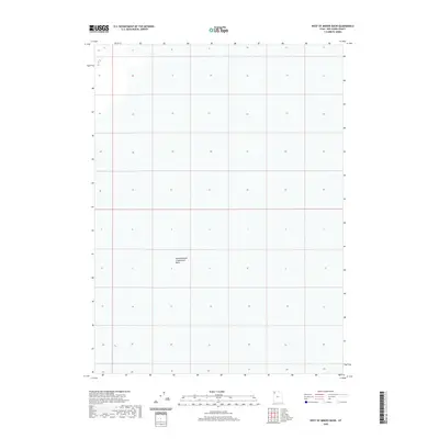
2020 Map of West of Miners Basin
USGS Topo · Published 2020About this map
Newfoundland Evaporation Basin dominates this desolate stretch of Box Elder County, illustrating the stark industrial and environmental interface of Utah's salt flats. Located in the West of Miners Basin area, the map reveals the geometric precision of the Public Land Survey System against a landscape primarily defined by hydrology rather than settlement. The presence of this basin indicates the region's specialized utility for mineral extraction or evaporation processes in the early 21st century. With very few named landmarks beyond this massive water feature, the topography is characterized by subtle elevation changes across a seemingly endless expanse, providing a clear record of the area's specialized geography.
Find a feature on this map
1 named feature on this map. Tap any name to fly to it.
Don’t see what you’re looking for? This feature index may not catch every label — zoom into the map to look around manually.
Map Details
Editions of this 2020 West of Miners Basin Map
This is the sole edition of this map. No revisions or reprints were ever made.
Other maps of this area

1954 · Brigham City
USGS Topo · 1:250,000

1958 · Brigham City
USGS Topo · 1:250,000

1962 · Brigham City
USGS Topo · 1:250,000

1983 · Jackson
USGS Topo · 1:24,000

1983 · Lemay
USGS Topo · 1:24,000
1983 · Lucin 4 SW
USGS Topo · 1:24,000

1983 · Bovine SE
USGS Topo · 1:24,000
1983 · Big Pass
USGS Topo · 1:24,000

1983 · Lucin 4 NE
USGS Topo · 1:24,000
1983 · Miners Basin
USGS Topo · 1:24,000