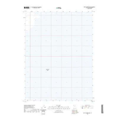
2023 Map of West of Miners Basin
USGS Topo · Published 2023About this map
Newfoundland Evaporation Basin occupies the central expanse of this survey in western Box Elder County. The landscape is defined by the unique hydrology of the Great Salt Lake desert, where mineral extraction and evaporation processes have shaped the surface. This high-resolution study, based on 2018 NAIP imagery, captures the precise grid of the public land survey system across a region of intense industrial and environmental interaction. The map illustrates the vast, flat terrain of the Newfoundland Evaporation Basin, providing an essential view of the area's modern topography and water management footprints.
Find a feature on this map
1 named feature on this map. Tap any name to fly to it.
Don’t see what you’re looking for? This feature index may not catch every label — zoom into the map to look around manually.
Map Details
Editions of this 2023 West of Miners Basin Map
This is the sole edition of this map. No revisions or reprints were ever made.
Other maps of this area

1954 · Brigham City
USGS Topo · 1:250,000

1958 · Brigham City
USGS Topo · 1:250,000

1962 · Brigham City
USGS Topo · 1:250,000

1983 · Jackson
USGS Topo · 1:24,000

1983 · Lemay
USGS Topo · 1:24,000
1983 · Lucin 4 SW
USGS Topo · 1:24,000

1983 · Bovine SE
USGS Topo · 1:24,000
1983 · Big Pass
USGS Topo · 1:24,000

1983 · Lucin 4 NE
USGS Topo · 1:24,000
1983 · Miners Basin
USGS Topo · 1:24,000