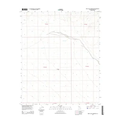
2015 Map of West of Palo Verde Peak
USGS Topo · Published 2015About this map
Milpitas Wash defines the drainage patterns of this arid landscape in eastern Imperial County, cutting through the terrain as it flows toward the Colorado River valley. The map documents the vast, open reaches of Smoketree Valley, a name that suggests the specific desert flora found within these dry alluvial plains. This 2015 edition reflects the modern cartographic state of the region, emphasizing the natural topography and the Public Land Survey System grid through townships such as t10s r19e and t9s r20e. The absence of developed townsites or major highways highlights the area’s character as an undeveloped desert corridor, where the land is primarily shaped by ephemeral watercourses and the natural slope of the basin.
Find a feature on this map
8 named features on this map. Tap any name to fly to it.
Don’t see what you’re looking for? This feature index may not catch every label — zoom into the map to look around manually.
Map Details
Editions of this 2015 West of Palo Verde Peak Map
This is the sole edition of this map. No revisions or reprints were ever made.
Other maps of this area

1942 · Blythe
USGS Topo · 1:250,000

1953 · Palo Verde Mountains
USGS Topo · 1:62,500

1953 · Quartz Peak
USGS Topo · 1:62,500

1953 · Chuckwalla Spring
USGS Topo · 1:62,500

1953 · Acolita
USGS Topo · 1:62,500

1954 · Salton Sea
USGS Topo · 1:250,000

1955 · Salton Sea
USGS Topo · 1:250,000

1959 · Salton Sea
USGS Topo · 1:250,000

1963 · Salton Sea
USGS Topo · 1:250,000

1965 · Salton Sea
USGS Topo · 1:250,000