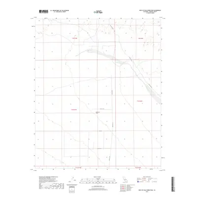
2018 Map of West of Palo Verde Peak
USGS Topo · Published 2018About this map
Smoketree Valley occupies the heart of this Imperial County landscape, characterized by the expansive drainage system of Milpitas Wash. In this 2018 survey, the area remains largely defined by its topography and a sparse network of desert roads including Midway Well Rd and Dietz Rd. A notable localized landmark, Big John Lupe, stands out within the valley floor, providing a specific point of reference in an otherwise broad alluvial terrain. The map meticulously documents the Public Land Survey System grid across multiple townships, such as t10s r19e, illustrating the intersection of modern cartography with historical land divisions. This map serves as an essential record for those studying the arid geography west of the Colorado River valley, where the alignment of Milpitas Wash Rd follows the natural contours of the wash.
Find a feature on this map
13 named features on this map. Tap any name to fly to it.
Don’t see what you’re looking for? This feature index may not catch every label — zoom into the map to look around manually.
Map Details
Editions of this 2018 West of Palo Verde Peak Map
This is the sole edition of this map. No revisions or reprints were ever made.
Other maps of this area

1942 · Blythe
USGS Topo · 1:250,000

1953 · Palo Verde Mountains
USGS Topo · 1:62,500

1953 · Quartz Peak
USGS Topo · 1:62,500

1953 · Chuckwalla Spring
USGS Topo · 1:62,500

1953 · Acolita
USGS Topo · 1:62,500

1954 · Salton Sea
USGS Topo · 1:250,000

1955 · Salton Sea
USGS Topo · 1:250,000

1959 · Salton Sea
USGS Topo · 1:250,000

1963 · Salton Sea
USGS Topo · 1:250,000

1965 · Salton Sea
USGS Topo · 1:250,000