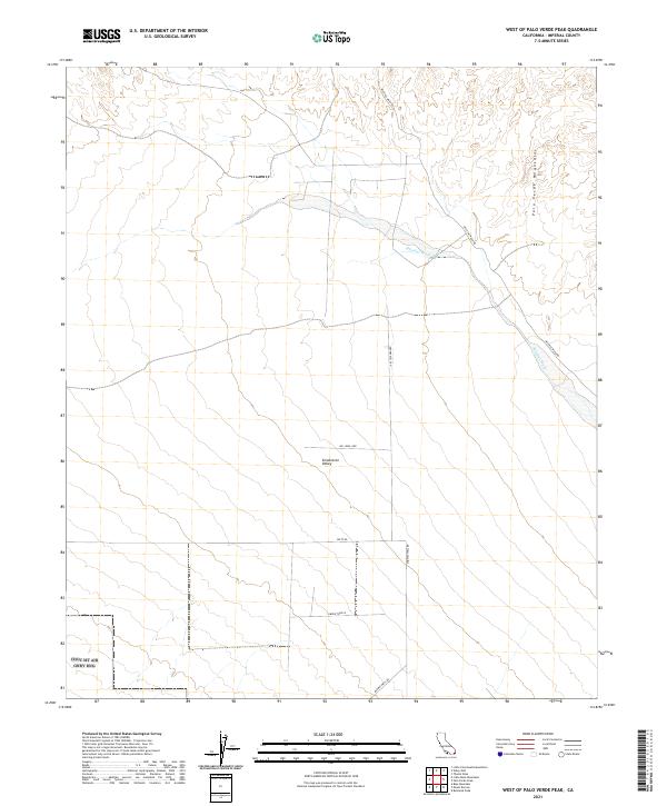
2021 Map of West of Palo Verde Peak
USGS Topo · Published 2021About this map
Smoketree Valley and the northern reaches of the Palo Verde Mountains define this arid landscape in eastern Imperial County. This modern survey illustrates a topography of desert washes and low peaks, characterized by the prominent Milpitas Wash as it trends toward the southeast. The interior drainage patterns are clearly delineated, showing the natural conduits that shape the valley floor between the mountain ranges.
Find a feature on this map
14 named features on this map. Tap any name to fly to it.
Don’t see what you’re looking for? This feature index may not catch every label — zoom into the map to look around manually.
Map Details
Editions of this 2021 West of Palo Verde Peak Map
This is the sole edition of this map. No revisions or reprints were ever made.
Other maps of this area

1942 · Blythe
USGS Topo · 1:250,000

1953 · Palo Verde Mountains
USGS Topo · 1:62,500

1953 · Quartz Peak
USGS Topo · 1:62,500

1953 · Chuckwalla Spring
USGS Topo · 1:62,500

1953 · Acolita
USGS Topo · 1:62,500

1954 · Salton Sea
USGS Topo · 1:250,000

1955 · Salton Sea
USGS Topo · 1:250,000

1959 · Salton Sea
USGS Topo · 1:250,000

1963 · Salton Sea
USGS Topo · 1:250,000

1965 · Salton Sea
USGS Topo · 1:250,000