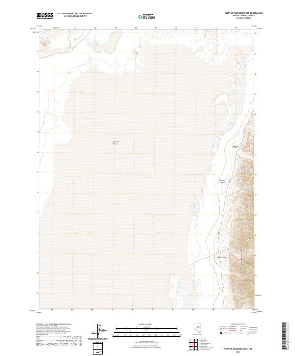
2021 Map of West of Railroad Pass
USGS Topo · Published 2021About this map
Diamond Valley occupies the expansive western portion of this map, meeting the dramatic vertical rise of the Diamond Mountains along its eastern edge. This transition between the flat valley floor and the high ridgeline is defined by a series of drainage systems, including Fourmile Canyon, Fivemile Canyon, and Davis Canyon. These features illustrate the characteristic basin-and-range topography of central Nevada, where runoff from the high peaks has carved distinct paths toward the valley sink. Modern infrastructure is sparse, represented primarily by Co Rte 101, which skirts the base of the mountains. The map provides a clear look at the Public Land Survey System grid across T25N and T26N, highlighting how the vast interior of Diamond Valley was historically sectioned for grazing and land management.
Find a feature on this map
10 named features on this map. Tap any name to fly to it.
Don’t see what you’re looking for? This feature index may not catch every label — zoom into the map to look around manually.
Map Details
Editions of this 2021 West of Railroad Pass Map
This is the sole edition of this map. No revisions or reprints were ever made.
Other maps of this area

1926 · Roberts Mountains
USGS Topo · 1:250,000

1929 · Roberts Mountains
USGS Topo · 1:250,000

1934 · Jiggs
USGS Topo · 1:125,000

1937 · Mineral Hill
USGS Topo · 1:48,000

1937 · Jiggs
USGS Topo · 1:125,000

1943 · Mineral Hill
USGS Topo · 1:62,500

1949 · Garden Valley
USGS Topo · 1:62,500

1951 · Garden Valley
USGS Topo · 1:62,500

1955 · Millett
USGS Topo · 1:250,000

1955 · Winnemucca
USGS Topo · 1:250,000