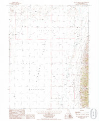
1985 Map of West of Railroad Pass
USGS Topo · Published 1986About this map
Diamond Valley dominates this arid landscape, a vast interior basin where the lack of an outlet creates the prominent Alkali Flat. This terminal sink is a defining characteristic of the high desert terrain in Eureka and Elko counties, marked by numerous seasonal springs that emerge at the edges of the salt crust. To the east, the topography shifts abruptly as the valley floor meets the rising foothills, carved by drainages such as Davis Canyon, Fivemile Canyon, and Fourmile Canyon. The 1980s data illustrates the hydrological complexity of this environment, where water is scarce but geologic features like the sprawling Alkali Flats indicate the historical movement and evaporation of mineral-laden runoff from the surrounding ranges.
Find a feature on this map
10 named features on this map. Tap any name to fly to it.
Don’t see what you’re looking for? This feature index may not catch every label — zoom into the map to look around manually.
Map Details
Editions of this 1985 West of Railroad Pass Map
This is the sole edition of this map. No revisions or reprints were ever made.
Other maps of this area

1926 · Roberts Mountains
USGS Topo · 1:250,000

1929 · Roberts Mountains
USGS Topo · 1:250,000

1934 · Jiggs
USGS Topo · 1:125,000

1937 · Mineral Hill
USGS Topo · 1:48,000

1937 · Jiggs
USGS Topo · 1:125,000

1943 · Mineral Hill
USGS Topo · 1:62,500

1949 · Garden Valley
USGS Topo · 1:62,500

1951 · Garden Valley
USGS Topo · 1:62,500

1955 · Millett
USGS Topo · 1:250,000

1955 · Winnemucca
USGS Topo · 1:250,000