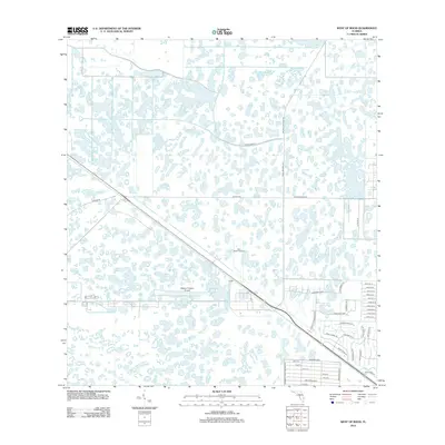
2012 Map of West of Rood
USGS Topo · Published 2012About this map
William P Gwinn Airport and the Palm Beach Raceway dominate this section of Palm Beach County, where the industrial and recreational landscape meets the marshy terrain of the Florida interior. The map reveals a transition from natural wetlands to managed infrastructure, anchored by the diagonal corridor of Co Hwy-706. To the east, a specialized cluster of development emerges along Park of Commerce Blvd and Commerce Rd W, featuring a dense grid of local streets including Corporate Way and Corporate Rd N. This area reflects the modern growth of logistical and high-tech hubs positioned away from the coast. Residential and rural access is maintained through a network of family and nature-themed lanes such as Black Bear Rd and Broken Wing Ln, while Canal Road 6 highlights the region's essential water management system.
Find a feature on this map
43 named features on this map. Tap any name to fly to it.
Don’t see what you’re looking for? This feature index may not catch every label — zoom into the map to look around manually.
Map Details
Editions of this 2012 West of Rood Map
This is the sole edition of this map. No revisions or reprints were ever made.
Other maps of this area

1945 · Delta
USGS Topo · 1:24,000

1948 · Rood
USGS Topo · 1:24,000

1948 · Gomez
USGS Topo · 1:24,000

1949 · Rood
USGS Topo · 1:24,000

1949 · Gomez
USGS Topo · 1:24,000

1950 · Delta
USGS Topo · 1:24,000

1953 · Indian Town SE
USGS Topo · 1:24,000

1953 · Indian Town
USGS Topo · 1:24,000

1956 · West Palm Beach
USGS Topo · 1:250,000

1956 · Fort Pierce
USGS Topo · 1:250,000