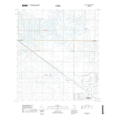
2018 Map of West of Rood
USGS Topo · Published 2018About this map
Palm Beach Gardens expands into the southeastern corner of this Florida landscape, where suburban development meets the wetland systems and industrial corridors of the northern Everglades. This area, located near the Martin Co Palm Beach Co line, reveals a transition from natural wetlands to planned commercial and residential spaces. The southern portion of the map is defined by a dense network of residential streets such as Grapeview Blvd and Caloosa Blvd, alongside industrial hubs like Park of Commerce Blvd. Farther north, the land remains largely open, punctuated by the William P Gwinn Airport and major thoroughfares including W Indiantown Rd and Pratt Whitney Rd. The survey illustrates the late-twentieth-century growth patterns of the region, where infrastructure like Innovation Dr and Endeavor Dr began encroaching upon the historic wilderness of the interior.
Find a feature on this map
46 named features on this map. Tap any name to fly to it.
Don’t see what you’re looking for? This feature index may not catch every label — zoom into the map to look around manually.
Map Details
Editions of this 2018 West of Rood Map
This is the sole edition of this map. No revisions or reprints were ever made.
Other maps of this area

1945 · Delta
USGS Topo · 1:24,000

1948 · Rood
USGS Topo · 1:24,000

1948 · Gomez
USGS Topo · 1:24,000

1949 · Rood
USGS Topo · 1:24,000

1949 · Gomez
USGS Topo · 1:24,000

1950 · Delta
USGS Topo · 1:24,000

1953 · Indian Town SE
USGS Topo · 1:24,000

1953 · Indian Town
USGS Topo · 1:24,000

1956 · West Palm Beach
USGS Topo · 1:250,000

1956 · Fort Pierce
USGS Topo · 1:250,000