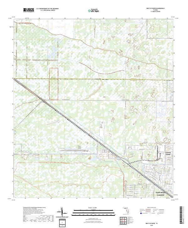
2024 Map of West of Rood
USGS Topo · Published 2024About this map
Hungryland Wildlife And Environmental Area dominates the central and northern reaches of this Florida landscape, where conservation land meets the expanding residential and industrial fringes of the coast. The transition from the wetlands of the interior to the more developed edges is marked by the presence of Jupiter Farms and the northwestern edge of Palm Beach Gardens. Transportation corridors like W Indiantown Rd and State Hwy 711 bridge the gap between these natural areas and the coastal economy.
Find a feature on this map
52 named features on this map. Tap any name to fly to it.
Don’t see what you’re looking for? This feature index may not catch every label — zoom into the map to look around manually.
Map Details
Editions of this 2024 West of Rood Map
This is the sole edition of this map. No revisions or reprints were ever made.
Other maps of this area

1945 · Delta
USGS Topo · 1:24,000

1948 · Rood
USGS Topo · 1:24,000

1948 · Gomez
USGS Topo · 1:24,000

1949 · Rood
USGS Topo · 1:24,000

1949 · Gomez
USGS Topo · 1:24,000

1950 · Delta
USGS Topo · 1:24,000

1953 · Indian Town SE
USGS Topo · 1:24,000

1953 · Indian Town
USGS Topo · 1:24,000

1956 · West Palm Beach
USGS Topo · 1:250,000

1956 · Fort Pierce
USGS Topo · 1:250,000