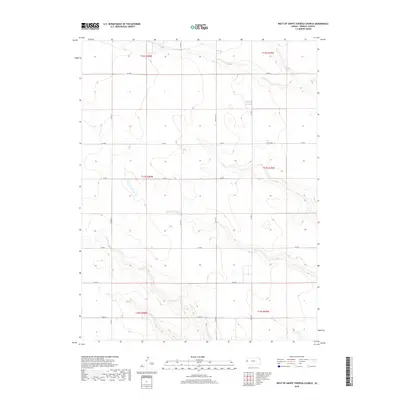
2018 Map of West of Sainte Theresa Church
USGS Topo · Published 2018About this map
The high plains of western Greeley County are defined here by a precise grid of rural thoroughfares, including Whitelaw Rd and Road N. This area, situated just west of the Sainte Theresa Church community, exhibits the classic Section-Township-Range organization of the American West. The landscape is marked by intermittent drainage patterns and small depressions that gather water across the open tableland. Regional travel is facilitated by a network of county roads such as Co Rd 19 and Co Rd 17, which provide access to remote agricultural tracts. Though primarily focused on the physical geography and road network, the survey captures the subtle topographic variations that have shaped land use in this part of Kansas since the initial homesteading era. Boundaries like t17s r40w and t16s r39w delineate the vast townships that comprise this rural territory.
Find a feature on this map
18 named features on this map. Tap any name to fly to it.
Don’t see what you’re looking for? This feature index may not catch every label — zoom into the map to look around manually.
Map Details
Editions of this 2018 West of Sainte Theresa Church Map
This is the sole edition of this map. No revisions or reprints were ever made.
Other maps of this area

1955 · Scott City
USGS Topo · 1:250,000

1958 · Scott City
USGS Topo · 1:250,000

1968 · Sharon Springs 3 NE
USGS Topo · 1:24,000

1968 · Sharon Springs 4 NW
USGS Topo · 1:24,000

1968 · Sharon Springs 4 NE
USGS Topo · 1:24,000

1970 · Sharon Springs 4 SE
USGS Topo · 1:24,000

1970 · Sharon Springs 3 SE
USGS Topo · 1:24,000

1970 · Sharon Springs 4 SW
USGS Topo · 1:24,000

1970 · Selkirk
USGS Topo · 1:24,000

1970 · Selkirk NW
USGS Topo · 1:24,000