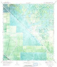
1971 Map of West Palm Beach 2 SW
USGS Topo · Published 1984About this map
Corbett State Wildlife Management Area dominates this northern Florida landscape, revealing a mosaic of wetlands and hammocks preserved before the full reach of coastal expansion. The map is defined by a rigid grid of industrial water management, where the L-8 Canal and Big Mound Canal cut diagonal and vertical lines across the natural terrain to control the flow toward the West Palm Beach Canal. This intersection of wild land and civil engineering is punctuated by remote landmarks like the Landing Strip and the natural rise of Big Mound. The topographic data from this 1970 survey captures the region just before significant land-use changes, documenting a specialized network of pumps and bench marks essential for navigating and draining this interior territory.
Find a feature on this map
18 named features on this map. Tap any name to fly to it.
Don’t see what you’re looking for? This feature index may not catch every label — zoom into the map to look around manually.
Map Details
Editions of this 1971 West Palm Beach 2 SW Map
This is the sole edition of this map. No revisions or reprints were ever made.
Other maps of this area

1956 · West Palm Beach
USGS Topo · 1:250,000

1957 · West Palm Beach
USGS Topo · 1:250,000

1958 · West Palm Beach
USGS Topo · 1:250,000

1970 · West Palm Beach 2 SW
USGS Topo · 1:24,000

1970 · Loxahatchee NW
USGS Topo · 1:24,000
1970 · West Palm Beach 2 NE
USGS Topo · 1:24,000

1970 · Bryant
USGS Topo · 1:24,000

1970 · Sixmile Bend
USGS Topo · 1:24,000
1970 · West Palm Beach 2 NW
USGS Topo · 1:24,000
1971 · West Palm Beach 2 SE
USGS Topo · 1:24,000