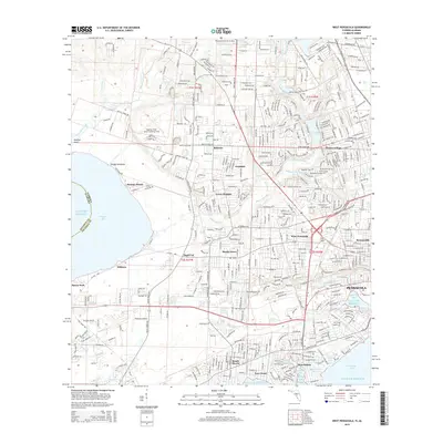
2015 Map of West Pensacola
USGS Topo · Published 2015About this map
Saufley Field Naval Outlying Field and Ferguson Airport anchor the aviation-heavy landscape west of downtown Pensacola. The terrain is defined by the winding course of Bayou Marcus, which flows toward Perdido Bay at the Alabama-Florida state line. Settlement patterns show a dense grid of neighborhoods including Myrtle Grove, West Pensacola, and Bellview, while the southern shoreline along Bayou Grande and Pensacola Bay features coastal communities like Navy Point and Beach Haven. For genealogists and local historians, this map identifies several significant burial grounds, including Pensacola Memorial Gardens and Resthaven Gardens. The transition from urban density in Brownsville to the wetlands along Elevenmile Creek illustrates the mid-2010s suburban and natural balance of Escambia County.
Find a feature on this map
44 named features on this map. Tap any name to fly to it.
Don’t see what you’re looking for? This feature index may not catch every label — zoom into the map to look around manually.
Map Details
Editions of this 2015 West Pensacola Map
This is the sole edition of this map. No revisions or reprints were ever made.
Other maps of this area

1920 · Milton
USGS Topo · 1:62,500

1921 · Pensacola
USGS Topo · 1:62,500

1921 · Fort Barrancas
USGS Topo · 1:62,500

1921 · Muscogee
USGS Topo · 1:62,500

1941 · Fort Barrancas
USGS Topo · 1:62,500

1941 · Muscogee
USGS Topo · 1:62,500

1941 · Pensacola
USGS Topo · 1:62,500

1941 · Milton
USGS Topo · 1:62,500

1942 · Pensacola
USGS Topo · 1:62,500

1943 · Muscogee
USGS Topo · 1:62,500