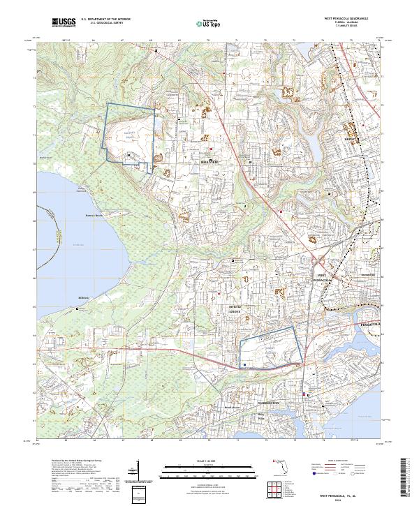
2024 Map of West Pensacola
USGS Topo · Published 2024About this map
Bellview and West Pensacola anchor this coastal Florida landscape, where the urban expansion of the western panhandle meets the intricate waterways of Perdido Bay and Pensacola Bay. The area is defined by its military and aviation presence, centered on the significant footprints of Saufley Field and Corry Station. These installations are surrounded by a dense network of residential neighborhoods like Myrtle Grove and Brent, which grew alongside arterial roads such as Lillian Hwy and Blue Angel Pkwy.
Find a feature on this map
114 named features on this map. Tap any name to fly to it.
Don’t see what you’re looking for? This feature index may not catch every label — zoom into the map to look around manually.
Map Details
Editions of this 2024 West Pensacola Map
This is the sole edition of this map. No revisions or reprints were ever made.
Other maps of this area

1920 · Milton
USGS Topo · 1:62,500

1921 · Pensacola
USGS Topo · 1:62,500

1921 · Fort Barrancas
USGS Topo · 1:62,500

1921 · Muscogee
USGS Topo · 1:62,500

1941 · Fort Barrancas
USGS Topo · 1:62,500

1941 · Muscogee
USGS Topo · 1:62,500

1941 · Pensacola
USGS Topo · 1:62,500

1941 · Milton
USGS Topo · 1:62,500

1942 · Pensacola
USGS Topo · 1:62,500

1943 · Muscogee
USGS Topo · 1:62,500