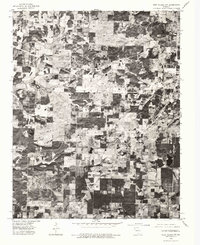
1976 Map of West Plains NW
USGS Topo · Published 1977About this map
West Plains serves as the primary urban center in this orthophotoquad, which showcases the transition from town lots to the sprawling agricultural and timber tracts of southern Missouri. The aerial perspective from 1976 reveals a landscape defined by irregular forest patches and cleared pastureland, with the Spring River cutting across the southern portion of the sheet. The small community of South Fork anchors the southwestern corner, illustrating the dispersed settlement patterns typical of the Ozarks during this era. This specific photographic survey provides a clear view of the road network and land-use divisions before further modern development, making it a valuable tool for understanding the mid-1970s rural layout of Howell County.
Find a feature on this map
3 named features on this map. Tap any name to fly to it.
Don’t see what you’re looking for? This feature index may not catch every label — zoom into the map to look around manually.
Map Details
Editions of this 1976 West Plains NW Map
This is the sole edition of this map. No revisions or reprints were ever made.
Other maps of this area

1938 · West Plains
USGS Topo · 1:24,000

1939 · Topaz
USGS Topo · 1:62,500

1940 · West Plains
USGS Topo · 1:24,000

1941 · Topaz
USGS Topo · 1:62,500

1944 · West Plains
USGS Topo · 1:62,500

1944 · Cureall
USGS Topo · 1:62,500

1945 · Harrison
USGS Topo · 1:250,000

1945 · Willow Springs
USGS Topo · 1:62,500

1946 · West Plains
USGS Topo · 1:62,500

1946 · Cureall
USGS Topo · 1:62,500