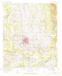
1959 Map of West Point
USGS Topo · Published 1972About this map
The city of West Point serves as the central hub of this mid-century landscape, situated at the junction of the Gulf Mobile and Ohio, Illinois Central, and Columbus and Greenville railroads. The surrounding countryside is densely populated with rural landmarks of genealogical importance, including Siloam Ch, Paine Chapel Cem, and Strong Hill Sch. The terrain is shaped by an intricate drainage system including Chuquatonchee Creek and the Tombigbee River, which flows past the settlement of Waverly in the southeast.
Find a feature on this map
114 named features on this map. Tap any name to fly to it.
Don’t see what you’re looking for? This feature index may not catch every label — zoom into the map to look around manually.
Map Details
Editions of this 1959 West Point Map
3 editions found
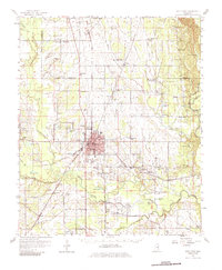
Other maps of this area

1953 · West Point
USGS Topo · 1:250,000

1958 · West Point
USGS Topo · 1:250,000

1959 · Artesia
USGS Topo · 1:62,500

1959 · West Point
USGS Topo · 1:62,500

1959 · Van Vleet
USGS Topo · 1:62,500

1959 · Pheba
USGS Topo · 1:62,500

1960 · Caledonia
USGS Topo · 1:62,500

1960 · Columbus
USGS Topo · 1:62,500

1963 · West Point
USGS Topo · 1:250,000

1965 · Starkville
USGS Topo · 1:24,000