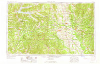
1963 Map of West Point
USGS Topo · Published 1963About this map
The Tombigbee River and Buttahatchee River define the eastern landscape of this mid-century survey, a region where the hill country meets the fertile prairie. Several major institutions anchor the map, including Wood Junior College near Mathiston and Mississippi State College on the outskirts of Starkville. The era's infrastructure is dominated by the Illinois Central and the Gulf Mobile & Ohio railroads, which facilitated the movement of timber and agricultural products from towns like West Point and Columbus. Environmental and military sites are notable, from the extensive Noxubee National Wildlife Refuge to the Mississippi National Guard Rifle Range. This collection of data points, including isolated churches like Hebron Ch and rural landmarks like the John T Miller Bridge, preserves the spatial relationship between Mississippi's college towns and its river-bottom industries before the expansion of the modern interstate system.
Find a feature on this map
68 named features on this map. Tap any name to fly to it.
Don’t see what you’re looking for? This feature index may not catch every label — zoom into the map to look around manually.
Map Details
Editions of this 1963 West Point Map
2 editions found

Other maps of this area

1927 · Eutaw
USGS Topo · 1:48,000

1931 · Eutaw
USGS Topo · 1:62,500

1932 · Philipp
USGS Topo · 1:48,000

1935 · Crowder
USGS Topo · 1:62,500

1935 · Philipp
USGS Topo · 1:62,500

1936 · Greenwood
USGS Topo · 1:62,500

1939 · Crowder
USGS Topo · 1:62,500

1939 · Philipp
USGS Topo · 1:62,500

1940 · Seven Pines
USGS Topo · 1:62,500

1940 · Lexington
USGS Topo · 1:62,500