
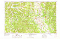
1963 Map of West Point
USGS Topo · Published 1963About this map
The Tombigbee River and the Pontotoc Ridge define the landscape of eastern Mississippi and western Alabama during this era of post-war growth. Significant industrial and regional hubs like Starkville and Columbus are shown connected by the Gulf Mobile & Ohio and Illinois Central railroads, highlighting the area's reliance on rail transport for timber and agriculture. To the north, the Grenada Dam impounds the waters of Grenada Lake, a major engineering feature that reshaped the Yalobusha River valley.
Find a feature on this map
48 named features on this map. Tap any name to fly to it.
Don’t see what you’re looking for? This feature index may not catch every label — zoom into the map to look around manually.
Map Details
Editions of this 1963 West Point Map
2 editions found
Other maps of this area

1927 · Eutaw
USGS Topo · 1:48,000

1931 · Eutaw
USGS Topo · 1:62,500

1932 · Philipp
USGS Topo · 1:48,000

1935 · Crowder
USGS Topo · 1:62,500

1935 · Philipp
USGS Topo · 1:62,500

1936 · Greenwood
USGS Topo · 1:62,500

1939 · Crowder
USGS Topo · 1:62,500

1939 · Philipp
USGS Topo · 1:62,500

1940 · Seven Pines
USGS Topo · 1:62,500

1940 · Lexington
USGS Topo · 1:62,500