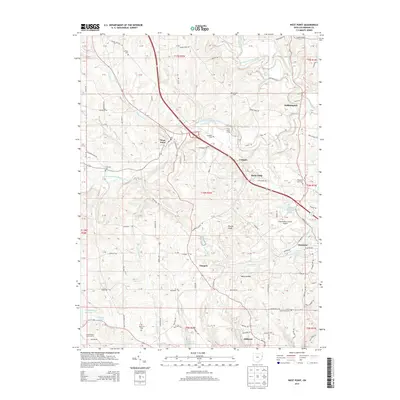
2013 Map of West Point
USGS Topo · Published 2013About this map
West Point and the surrounding townships of Columbiana County are defined by the winding paths of West Fork Little Beaver Creek and its many tributaries, including Patterson Cr and Brush Run. This 2013 survey illustrates a landscape where rural legacy and modern infrastructure coexist, shown by the proximity of several historic burial grounds like Carlisle Cem and Madison Cem to the Columbiana County Airport. The southern reaches of the map highlight significant water management features, including the Highlandtown Reservoir and the Wellsville City Reservoir. Small settlements like Williamsport, Glasgow, and Glenmoor are connected by a network of local routes such as Roller Coaster Rd and Cream Ridge Rd, reflecting the area's ongoing character as a cluster of residential pockets and family dairy operations like Smith Valley Dairy Farms.
Find a feature on this map
135 named features on this map. Tap any name to fly to it.
Don’t see what you’re looking for? This feature index may not catch every label — zoom into the map to look around manually.
Map Details
Editions of this 2013 West Point Map
This is the sole edition of this map. No revisions or reprints were ever made.
Other maps of this area

1904 · Wellsville
USGS Topo · 1:62,500

1905 · Salineville
USGS Topo · 1:62,500

1907 · Columbiana
USGS Topo · 1:62,500

1909 · Lisbon
USGS Topo · 1:62,500

1909 · Columbiana
USGS Topo · 1:62,500

1937 · Wellsville
USGS Topo · 1:62,500

1944 · Wellsville
USGS Topo · 1:62,500

1951 · Canton
USGS Topo · 1:250,000

1953 · Canton
USGS Topo · 1:250,000

1957 · Canton
USGS Topo · 1:250,000