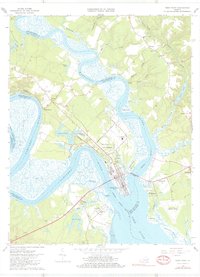
1965 Map of West Point
USGS Topo · Published 1980About this map
The confluence of the Mattaponi River and Pamunkey River at West Point dictates the landscape of this mid-1960s survey. As these two major tidal rivers merge to form the York River, the map reveals a dense network of marshes and shorelines, including the wide Eltham Marsh and Lee Marsh. The rail-and-water economy is evident through the Southern railway line and industrial infrastructure like the Sewage Disposal plant and various landings such as Ryefield Landing.
Find a feature on this map
74 named features on this map. Tap any name to fly to it.
Don’t see what you’re looking for? This feature index may not catch every label — zoom into the map to look around manually.
Map Details
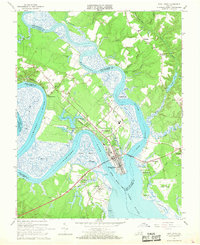
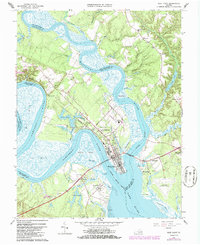
Editions of this 1965 West Point Map
3 editions found
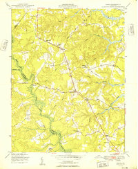
Other maps of this area

1906 · Williamsburg
USGS Topo · 1:62,500

1917 · Urbanna
USGS Topo · 1:62,500

1917 · Toano
USGS Topo · 1:62,500

1918 · Toano
USGS Topo · 1:62,500

1919 · New Kent
USGS Topo · 1:62,500

1943 · Richmond
USGS Topo · 1:250,000

1949 · Truhart
USGS Topo · 1:24,000

1949 · Shacklefords
USGS Topo · 1:24,000

1949 · King And Queen
USGS Topo · 1:24,000
1949 · Samos
USGS Topo · 1:24,000