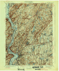
1941 Map of West Point
USGS Topo · Published 1941About this map
The Hudson River serves as the central artery for this 1941 edition, defining the boundaries between Orange and Putnam counties. Significant military and strategic installations dominate the riverbanks, including the West Point Military Reservation, Constitution Island, and the Naval Res near Iona I. To the east, the landscape transitions from the steep grades of Anthony's Nose and Bear Mountain into the inland hills and valleys of Philipstown and Putnam Valley. Transportation and utility networks are prominent, with the New York Central railroad following the water's edge and the newly developed Bronx River Parkway extension appearing near Peekskill. Local history is captured through named hamlets like Mohegan Lake and Jefferson Valley, along with several family-associated burial grounds such as Halstead Cem. The era's public works are evident in the sprawling Clarence Fahnestock Memorial Park and the various reservoirs like Amawalk Res supplying the region's water.
Find a feature on this map
166 named features on this map. Tap any name to fly to it.
Don’t see what you’re looking for? This feature index may not catch every label — zoom into the map to look around manually.
Map Details
Editions of this 1941 West Point Map
3 editions found
Other maps of this area

1891 · Ramapo
USGS Topo · 1:62,500

1892 · Stamford
USGS Topo · 1:62,500

1892 · West Point
USGS Topo · 1:62,500

1892 · Carmel
USGS Topo · 1:62,500

1892 · Tarrytown
USGS Topo · 1:62,500

1893 · Carmel
USGS Topo · 1:62,500

1893 · Stamford
USGS Topo · 1:62,500

1893 · Tarrytown
USGS Topo · 1:62,500

1893 · Ramapo
USGS Topo · 1:62,500

1893 · Clove
USGS Topo · 1:62,500