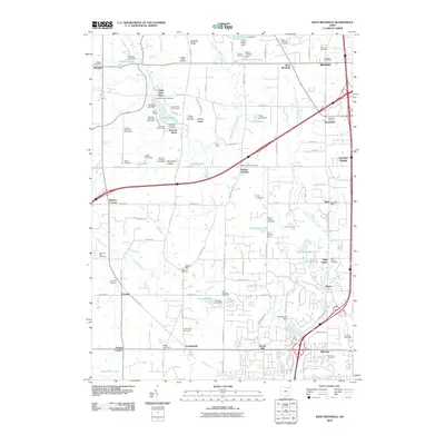
2010 Map of West Richfield
USGS Topo · Published 2010About this map
Whipps Ledges and the dramatic geological formation at Buzzard Roost anchor the western portion of this 2010 landscape, where the headwaters of the East Branch Rocky River and Yellow Creek create a network of small lakes and ponds. This transition between Medina and Summit Counties shows a mix of preserved parklands and burgeoning residential clusters near West Richfield and Montrose. Genealogists will find a high concentration of burial sites, including the Reed Hill Cemetery and Morris Chapel Cemetery, scattered across the rolling terrain. The presence of the Worden Heritage Homestead near Ledge Lake points to the area's agricultural roots, while the dense development around Richfield Heights and the interstate corridor reflects modern commercial expansion. Numerous small dams, such as the Kirby Lake Dam and Granger Lake Dam, reveal how local hydrology has been managed to create recreation and residential amenities like Lily Hill Lake.
Find a feature on this map
107 named features on this map. Tap any name to fly to it.
Don’t see what you’re looking for? This feature index may not catch every label — zoom into the map to look around manually.
Map Details
Editions of this 2010 West Richfield Map
This is the sole edition of this map. No revisions or reprints were ever made.
Other maps of this area

1902 · Berea
USGS Topo · 1:62,500

1903 · Cleveland
USGS Topo · 1:62,500

1903 · Akron
USGS Topo · 1:62,500

1904 · Berea
USGS Topo · 1:62,500

1904 · Medina
USGS Topo · 1:62,500

1905 · Akron
USGS Topo · 1:62,500

1906 · Medina
USGS Topo · 1:62,500

1950 · Cleveland
USGS Topo · 1:250,000

1953 · Broadview Heights
USGS Topo · 1:24,000

1953 · Berea
USGS Topo · 1:24,000