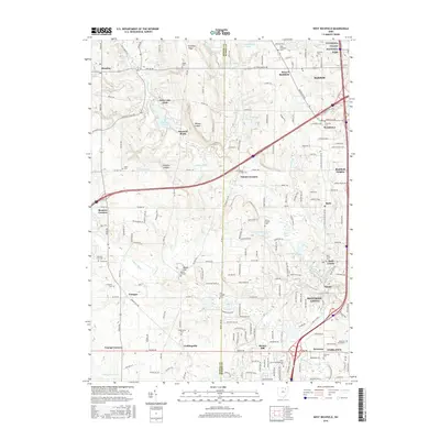
2016 Map of West Richfield
USGS Topo · Published 2016About this map
Whipps Ledges and Wordens Ledges mark the high, broken ground of the Medina Co Summit Co boundary, where the headwaters of the E Br Rocky River and Yellow Cr begin their descent. This 2016 survey shows the developed suburban landscape between Hinckley and Richfield, yet preserves the locations of numerous historic burying grounds like Beach Cem and the Morris Chapel Cem. The northeastern corner is anchored by the protected woodlands of the Cuyahoga Valley National Park, while further south, the map details the local centers of Bath Center, Ghent, and Montrose. Educational and recreational landmarks are prominent, from the Ohio Coll of Massotherapy Inc near Stoney Hill to the waters of Hinckley Lake and Granger Lake, reflecting a landscape defined by both modern infrastructure and its traditional rural roots.
Find a feature on this map
196 named features on this map. Tap any name to fly to it.
Don’t see what you’re looking for? This feature index may not catch every label — zoom into the map to look around manually.
Map Details
Editions of this 2016 West Richfield Map
This is the sole edition of this map. No revisions or reprints were ever made.
Other maps of this area

1902 · Berea
USGS Topo · 1:62,500

1903 · Cleveland
USGS Topo · 1:62,500

1903 · Akron
USGS Topo · 1:62,500

1904 · Berea
USGS Topo · 1:62,500

1904 · Medina
USGS Topo · 1:62,500

1905 · Akron
USGS Topo · 1:62,500

1906 · Medina
USGS Topo · 1:62,500

1950 · Cleveland
USGS Topo · 1:250,000

1953 · Broadview Heights
USGS Topo · 1:24,000

1953 · Berea
USGS Topo · 1:24,000