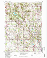
1994 Map of West Richfield
USGS Topo · Published 1997About this map
Hinckley Reservation dominates the northwestern portion of this 1990s landscape, centered around the Hinckley Lake reservoir and the notable Buzzard Roost overlook. This era in Medina and Summit counties shows a mix of preserved parklands and growing residential areas like Richfield Heights and Fairlawn. The map captures the interface between these communities and the older agricultural and rural foundations of the Connecticut Western Reserve. Local history is well-preserved in the numerous cemeteries such as Beach Cem and Ganyard Cem, alongside community landmarks like Morris Chapel and the Township School in Granger. The hydrology of the area is well-defined by the East Branch Rocky River and various water bodies including Bath Pond and Granger Lake, reflecting the well-watered character of the region as it transitioned toward the end of the century.
Find a feature on this map
68 named features on this map. Tap any name to fly to it.
Don’t see what you’re looking for? This feature index may not catch every label — zoom into the map to look around manually.
Map Details
Editions of this 1994 West Richfield Map
This is the sole edition of this map. No revisions or reprints were ever made.
Other maps of this area

1902 · Berea
USGS Topo · 1:62,500

1903 · Cleveland
USGS Topo · 1:62,500

1903 · Akron
USGS Topo · 1:62,500

1904 · Berea
USGS Topo · 1:62,500

1904 · Medina
USGS Topo · 1:62,500

1905 · Akron
USGS Topo · 1:62,500

1906 · Medina
USGS Topo · 1:62,500

1950 · Cleveland
USGS Topo · 1:250,000

1953 · Broadview Heights
USGS Topo · 1:24,000

1953 · Berea
USGS Topo · 1:24,000