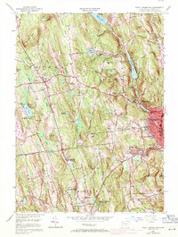
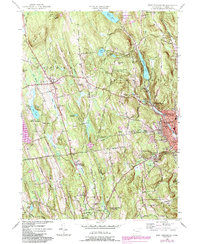
1956 Map of West Torrington
USGS Topo · Published 1971About this map
John Browns Birthplace (Ruins) stands as a notable landmark near Drakeville in this topographic study of the Litchfield Hills region. The landscape transitions from the urban expansion of Torrington in the southeast to the rural, high-elevation terrain of Ivy Mountain and Beech Hill. The industrial and municipal infrastructure of the mid-20th century is evident through features like the Litchfield Pumping Station and several reservoirs, including Stillwater Pond and Reuben Reservoir, which manage the West Branch Naugatuck River watershed. Education and specialized institutions are prominent across the quadrangle, including the Litchfield School For Boys, The Forman School, and the Junior Republic Of Connecticut. Genealogists will find numerous burial grounds preserved, such as the Old Middle Street Cemetery and Collins Cemetery.
Find a feature on this map
79 named features on this map. Tap any name to fly to it.
Don’t see what you’re looking for? This feature index may not catch every label — zoom into the map to look around manually.
Map Details
Editions of this 1956 West Torrington Map
5 editions found
Other maps of this area

1892 · Winsted
USGS Topo · 1:62,500

1892 · Cornwall
USGS Topo · 1:62,500

1892 · New Milford
USGS Topo · 1:62,500

1893 · Waterbury
USGS Topo · 1:62,500

1893 · New Milford
USGS Topo · 1:62,500

1893 · Cornwall
USGS Topo · 1:62,500

1903 · Cornwall
USGS Topo · 1:62,500

1904 · New Milford
USGS Topo · 1:62,500

1904 · Waterbury
USGS Topo · 1:62,500

1904 · Litchfield
USGS Topo · 1:125,000