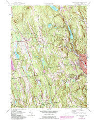
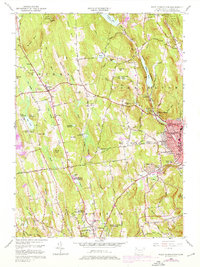
1956 Map of West Torrington
USGS Topo · Published 1984About this map
John Browns Birthplace (Ruins) stands on Brandy Hill north of Torrington, marking the historical depth of this Litchfield County landscape. The area is characterized by high ridges like Ivy Mtn and Lucas Beech Hill, which overlook a complex network of reservoirs and brooks that feed the Naugatuck River and its branches. This mid-century survey captures a diverse institutional footprint, including the Junior Republic of Connecticut, the St Louis De Montfort Seminary, and the Litchfield School For Boys. Local infrastructure is well-defined by industrial and municipal markers such as the Litchfield Pumping Sta and several cemeteries including Old Middle Street Cem and Newfield Cem. The transition from the rural town of Goshen to the more densely settled Torrington is evident, showing how the river valleys shaped development in the foothills of the Berkshires.
Find a feature on this map
62 named features on this map. Tap any name to fly to it.
Don’t see what you’re looking for? This feature index may not catch every label — zoom into the map to look around manually.
Map Details
Editions of this 1956 West Torrington Map
5 editions found
Other maps of this area

1892 · Winsted
USGS Topo · 1:62,500

1892 · Cornwall
USGS Topo · 1:62,500

1892 · New Milford
USGS Topo · 1:62,500

1893 · Waterbury
USGS Topo · 1:62,500

1893 · New Milford
USGS Topo · 1:62,500

1893 · Cornwall
USGS Topo · 1:62,500

1903 · Cornwall
USGS Topo · 1:62,500

1904 · New Milford
USGS Topo · 1:62,500

1904 · Waterbury
USGS Topo · 1:62,500

1904 · Litchfield
USGS Topo · 1:125,000