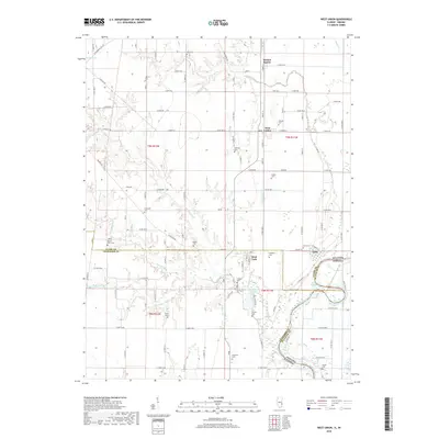
2018 Map of West Union
USGS Topo · Published 2018About this map
The Wabash River serves as the prominent natural and political boundary in this 2018 survey, separating Clark and Crawford Counties in Illinois from Sullivan County, Indiana. The village of York sits near the river's edge, adjacent to the York Cutoff and the winding Old Channel Lake, illustrating the dynamic nature of the river over time. Inland, the landscape is defined by the settlements of West Union, West York, and the rural community of Walnut Prairie.
Find a feature on this map
73 named features on this map. Tap any name to fly to it.
Don’t see what you’re looking for? This feature index may not catch every label — zoom into the map to look around manually.
Map Details
Editions of this 2018 West Union Map
This is the sole edition of this map. No revisions or reprints were ever made.
Other maps of this area

1932 · Marshall
USGS Topo · 1:62,500

1936 · Casey
USGS Topo · 1:48,000

1937 · Marshall
USGS Topo · 1:62,500

1942 · Fairbanks
USGS Topo · 1:24,000

1942 · Hutton
USGS Topo · 1:24,000

1942 · Casey
USGS Topo · 1:62,500

1943 · Casey
USGS Topo · 1:62,500

1943 · Merom
USGS Topo · 1:24,000

1952 · Fairbanks
USGS Topo · 1:24,000
1952 · Hutton
USGS Topo · 1:24,000