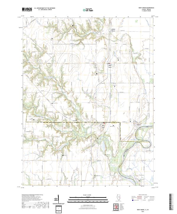
2024 Map of West Union
USGS Topo · Published 2024About this map
The Wabash River forms a shifting natural border between Illinois and Indiana, defining the eastern edge of this agricultural landscape. The river's influence is evident in features like the York Cutoff and Turman Island, while the York Ferry provides a rare river-crossing landmark near the settlement of York. The terrain is deeply carved by numerous drainages, including North Fork Raccoon Creek, South Fork Raccoon Creek, and Little Creek, which dictate the placement of rural roads and historical sites.
Find a feature on this map
62 named features on this map. Tap any name to fly to it.
Don’t see what you’re looking for? This feature index may not catch every label — zoom into the map to look around manually.
Map Details
Editions of this 2024 West Union Map
This is the sole edition of this map. No revisions or reprints were ever made.
Other maps of this area

1932 · Marshall
USGS Topo · 1:62,500

1936 · Casey
USGS Topo · 1:48,000

1937 · Marshall
USGS Topo · 1:62,500

1942 · Fairbanks
USGS Topo · 1:24,000

1942 · Hutton
USGS Topo · 1:24,000

1942 · Casey
USGS Topo · 1:62,500

1943 · Casey
USGS Topo · 1:62,500

1943 · Merom
USGS Topo · 1:24,000

1952 · Fairbanks
USGS Topo · 1:24,000
1952 · Hutton
USGS Topo · 1:24,000