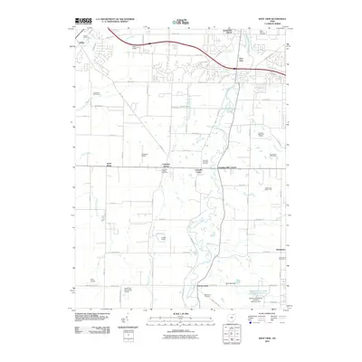
2010 Map of West View
USGS Topo · Published 2010About this map
The West Branch Rocky River meanders northward through this corner of Lorain and Cuyahoga counties, serving as the central drainage for a landscape transitioning from rural open space to suburban development. The community of Columbia Station stands at the heart of this area, anchored by the Columbia Station Post Office and the nearby Columbia Township Cemetery. The map reveals a dense concentration of local aviation and recreation, with small airstrips like Gilbert Airport, Columbia Airport, and Crocker Airport dotting the countryside alongside extensive fairways at Royal Crest Golf Course and Emerald woods Golf Course.
Find a feature on this map
75 named features on this map. Tap any name to fly to it.
Don’t see what you’re looking for? This feature index may not catch every label — zoom into the map to look around manually.
Map Details
Editions of this 2010 West View Map
This is the sole edition of this map. No revisions or reprints were ever made.
Other maps of this area

1901 · Oberlin
USGS Topo · 1:62,500

1902 · Berea
USGS Topo · 1:62,500

1903 · Oberlin
USGS Topo · 1:62,500

1904 · Berea
USGS Topo · 1:62,500

1904 · Medina
USGS Topo · 1:62,500

1904 · Wellington
USGS Topo · 1:62,500

1906 · Medina
USGS Topo · 1:62,500

1906 · Wellington
USGS Topo · 1:62,500

1950 · Cleveland
USGS Topo · 1:250,000

1953 · West View
USGS Topo · 1:24,000