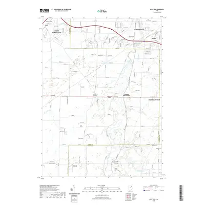
2019 Map of West View
USGS Topo · Published 2019About this map
The West Branch Rocky River defines the drainage and development patterns of this Ohio landscape, where the borders of Lorain, Cuyahoga, and Medina Counties converge. This 2019 survey captures the distinct transition between the expanding suburban fringes of Strongsville, Berea, and Olmsted Falls and the more open terrain of Columbia Center and Hardscrabble. The area's agricultural and industrial roots are visible in features like the Modern Tool and Die Company Reservoir and several localized airfields including Columbia Airport and Dorlon Airpark. Notable landforms such as Butternut Ridge and Quarry Ridge influenced early road placements, while numerous family-named burial grounds like Beebetown Cem and Myrtle Hill Cem provide essential anchor points for local genealogical research.
Find a feature on this map
70 named features on this map. Tap any name to fly to it.
Don’t see what you’re looking for? This feature index may not catch every label — zoom into the map to look around manually.
Map Details
Editions of this 2019 West View Map
This is the sole edition of this map. No revisions or reprints were ever made.
Other maps of this area

1901 · Oberlin
USGS Topo · 1:62,500

1902 · Berea
USGS Topo · 1:62,500

1903 · Oberlin
USGS Topo · 1:62,500

1904 · Berea
USGS Topo · 1:62,500

1904 · Medina
USGS Topo · 1:62,500

1904 · Wellington
USGS Topo · 1:62,500

1906 · Medina
USGS Topo · 1:62,500

1906 · Wellington
USGS Topo · 1:62,500

1950 · Cleveland
USGS Topo · 1:250,000

1953 · West View
USGS Topo · 1:24,000