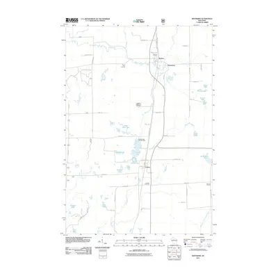
2011 Map of Westboro
USGS Topo · Published 2011About this map
Westboro and Chelsea anchor this central Wisconsin corridor along Business Highway 13, a landscape defined by the drainage of the Black River and Mondeaux River. This 2011 survey reveals a region shaped by its glacial hydrology, featuring numerous kettle ponds and larger water bodies like Chelsea Lake and Wellington Lake. The distribution of burial grounds, including Northside Cemetery and Saint Ann Cemetery, provides a genealogical framework for the surrounding townships. Civil engineering is evident in the water management structures such as the Eugene Mathey E 5228 Dam and the Chelsea Lake 2WP1491 Dam. The northern portion of the map includes the small settlement of Queenstown and the Pine Line Trl, which follows a former rail corridor, illustrating the transition from industrial transport to contemporary recreational land use.
Find a feature on this map
67 named features on this map. Tap any name to fly to it.
Don’t see what you’re looking for? This feature index may not catch every label — zoom into the map to look around manually.
Map Details
Editions of this 2011 Westboro Map
This is the sole edition of this map. No revisions or reprints were ever made.
Other maps of this area

1902 · Marathon
USGS Topo · 1:125,000

1944 · Ogema
USGS Topo · 1:48,000

1945 · Rib Lake
USGS Topo · 1:48,000

1947 · Rib Lake
USGS Topo · 1:48,000

1947 · Ogema
USGS Topo · 1:48,000

1949 · Ogema
USGS Topo · 1:48,000

1949 · Rib Lake
USGS Topo · 1:48,000

1951 · Athens
USGS Topo · 1:48,000

1951 · Medford
USGS Topo · 1:48,000

1953 · Rice Lake
USGS Topo · 1:250,000