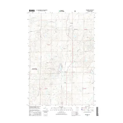
2015 Map of Westboro
USGS Topo · Published 2015About this map
Westboro and Chelsea anchor this survey of northern Taylor County, where the landscape is defined by the transition from settled townships to the dense woodlands of the Chequamegon National Forest. The map captures a region shaped by its glacial history, evidenced by the winding path of the Ice Age National Scenic Trail and a dense concentration of kettle lakes such as Skinner Lake and Kettle Lake. The settlement pattern follows the corridor of the Black River and the historical rail route now represented by State Hwy 13 Bus. Local heritage is well-preserved through numerous rural burial grounds, including Mount Olive Cem and the Chelsea Cemeteries, which serve as vital markers for genealogical research in this part of Wisconsin. Large water bodies like Chelsea Lake and Wellington Lake dominate the central and eastern portions of the quadrangle, illustrating the importance of these wetlands to the local geography.
Find a feature on this map
55 named features on this map. Tap any name to fly to it.
Don’t see what you’re looking for? This feature index may not catch every label — zoom into the map to look around manually.
Map Details
Editions of this 2015 Westboro Map
This is the sole edition of this map. No revisions or reprints were ever made.
Other maps of this area

1902 · Marathon
USGS Topo · 1:125,000

1944 · Ogema
USGS Topo · 1:48,000

1945 · Rib Lake
USGS Topo · 1:48,000

1947 · Rib Lake
USGS Topo · 1:48,000

1947 · Ogema
USGS Topo · 1:48,000

1949 · Ogema
USGS Topo · 1:48,000

1949 · Rib Lake
USGS Topo · 1:48,000

1951 · Athens
USGS Topo · 1:48,000

1951 · Medford
USGS Topo · 1:48,000

1953 · Rice Lake
USGS Topo · 1:250,000