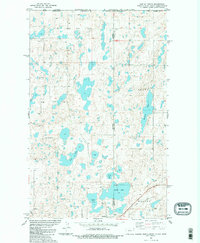
1983 Map of Westby North
USGS Topo · Published 1984About this map
The Flat Lake Oil Field dominates the northern landscape of this prairie region where the borders of Montana, North Dakota, and Canada converge. Numerous drilling sites, including Oil Well 2204 and a Flowing Well, are scattered across the terrain, illustrating the significant petroleum industry activity of the early 1980s. Near the southern edge of the sheet, the town of Westby serves as a local hub, featuring an Athletic Field, a Cem, and a local Gravel Pit.
Find a feature on this map
24 named features on this map. Tap any name to fly to it.
Don’t see what you’re looking for? This feature index may not catch every label — zoom into the map to look around manually.
Map Details
Editions of this 1983 Westby North Map
2 editions found
Other maps of this area

1953 · Williston
USGS Topo · 1:250,000

1954 · Wolf Point
USGS Topo · 1:250,000

1957 · Williston
USGS Topo · 1:250,000

1958 · Wolf Point
USGS Topo · 1:250,000

1983 · Tadpole Lake
USGS Topo · 1:24,000

1983 · Lone Tree Lake
USGS Topo · 1:24,000

1983 · Westby South
USGS Topo · 1:24,000

1983 · Alkabo
USGS Topo · 1:24,000

1983 · Westby North
USGS Topo · 1:24,000
1983 · Skjermo Lake
USGS Topo · 1:24,000