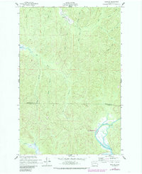
1956 Map of Western
USGS Topo · Published 1985About this map
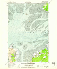
The settlement of Western serves as a focal point near the northern edge of this coastal Washington landscape, situated along the winding course of the Johns River. The terrain is defined by a dense network of drainage systems, including the Elk River and Cedar River, which reveal the hydrological complexity of the region before modern developments fully altered the natural flow. In the north, the Johns River State Wildlife Recreation Area marks a significant conservation zone where the river meets man-made features like Crawford Ditch. Along the southern reach, the North River is constrained by an extensive Levee, showing early efforts to manage the wetlands for agriculture or flood control. This survey provides a clear look at local landmarks such as BM 12 and various named tributaries like Florence Creek and Archer Creek, capturing the transition between the upland timber areas and the tidal river valleys.
Find a feature on this map
24 named features on this map. Tap any name to fly to it.
Don’t see what you’re looking for? This feature index may not catch every label — zoom into the map to look around manually.
Map Details
Editions of this 1956 Western Map
4 editions found

Other maps of this area

1938 · Cape Shoalwater
USGS Topo · 1:62,500

1938 · South Bend
USGS Topo · 1:62,500

1940 · South Bend
USGS Topo · 1:62,500

1941 · Grayland
USGS Topo · 1:62,500

1943 · Copalis Beach
USGS Topo · 1:250,000

1951 · Copalis Beach
USGS Topo · 1:250,000

1953 · Hoquiam
USGS Topo · 1:250,000

1955 · Aberdeen SE
USGS Topo · 1:24,000
1956 · North Cove
USGS Topo · 1:24,000
1956 · Westport
USGS Topo · 1:24,000