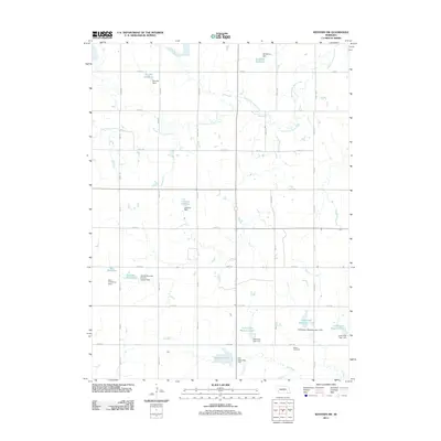
2011 Map of Western SW
USGS Topo · Published 2011About this map
South Fork Swan Creek and Cub Creek define the drainage of this agricultural landscape in Saline County, where modern water management dominates the rural geography. The map reveals a highly engineered watershed featuring numerous small-scale reservoirs and specialized infrastructure, such as the Floodwater Retarding Dam 15-B and the Harold Hummel Erosion Control Dam. These features, alongside Schwisow Reservoir and Jarchow Reservoir, illustrate the critical role of soil and water conservation in Nebraska's farming heartland.
Find a feature on this map
44 named features on this map. Tap any name to fly to it.
Don’t see what you’re looking for? This feature index may not catch every label — zoom into the map to look around manually.
Map Details
Editions of this 2011 Western SW Map
This is the sole edition of this map. No revisions or reprints were ever made.
Other maps of this area

1955 · Lincoln
USGS Topo · 1:250,000

1957 · Lincoln
USGS Topo · 1:250,000

1958 · Lincoln
USGS Topo · 1:250,000

1960 · Western SW
USGS Topo · 1:24,000

1960 · Fairbury
USGS Topo · 1:24,000
1960 · Gladstone
USGS Topo · 1:24,000

1960 · Daykin
USGS Topo · 1:24,000

1961 · Tobias
USGS Topo · 1:24,000

1961 · Western
USGS Topo · 1:24,000

1961 · Western SE
USGS Topo · 1:24,000