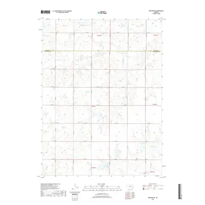
2017 Map of Western SW
USGS Topo · Published 2017About this map
Bower Cem sits in the southeastern corner of this agricultural landscape, a quiet marker of the generations that settled the plains along the Saline and Jefferson County line. The terrain is defined by a sophisticated system of water management, visible in the numerous reservoirs dotting the drainage basins of S Fork Swan Cr and Cub Cr. These features, including Murphy Reservoir and Herz Reservoir, reveal a mid-20th-century transition toward intensive water conservation to support the surrounding farmland. The section-line road network, including 726 RD and 720th RD, maintains the geometric order of the original Public Land Survey System, providing clear access for genealogists and local historians tracing land ownership across these rural townships.
Find a feature on this map
27 named features on this map. Tap any name to fly to it.
Don’t see what you’re looking for? This feature index may not catch every label — zoom into the map to look around manually.
Map Details
Editions of this 2017 Western SW Map
This is the sole edition of this map. No revisions or reprints were ever made.
Other maps of this area

1955 · Lincoln
USGS Topo · 1:250,000

1957 · Lincoln
USGS Topo · 1:250,000

1958 · Lincoln
USGS Topo · 1:250,000

1960 · Western SW
USGS Topo · 1:24,000

1960 · Fairbury
USGS Topo · 1:24,000
1960 · Gladstone
USGS Topo · 1:24,000

1960 · Daykin
USGS Topo · 1:24,000

1961 · Tobias
USGS Topo · 1:24,000

1961 · Western
USGS Topo · 1:24,000

1961 · Western SE
USGS Topo · 1:24,000