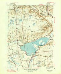
1947 Map of Westernville
USGS Topo · Published 1947About this map
The Mohawk River and its major impoundment, the Delta Reservoir, define the geography of this 1946 survey. This landscape shows the evolution of local water management, with the Rome Reservoir situated to the west and the expansive Delta Reservoir submerging former valley lands. The village of Westernville sits prominently on the eastern shore, serving as a focal point for a rural economy supported by numerous small schools such as School No 2 and Lower Quaker Hill Sch.
Find a feature on this map
48 named features on this map. Tap any name to fly to it.
Don’t see what you’re looking for? This feature index may not catch every label — zoom into the map to look around manually.
Map Details
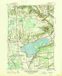
Editions of this 1947 Westernville Map
2 editions found
Other maps of this area

1895 · Oriskany
USGS Topo · 1:62,500

1895 · Oneida
USGS Topo · 1:62,500

1898 · Oneida
USGS Topo · 1:62,500

1898 · Oriskany
USGS Topo · 1:62,500

1902 · Oneida
USGS Topo · 1:62,500

1904 · Boonville
USGS Topo · 1:62,500

1905 · Taberg
USGS Topo · 1:62,500

1939 · Oneida
USGS Topo · 1:62,500

1943 · Lee Center
USGS Topo · 1:31,680

1944 · Point Rock
USGS Topo · 1:31,680