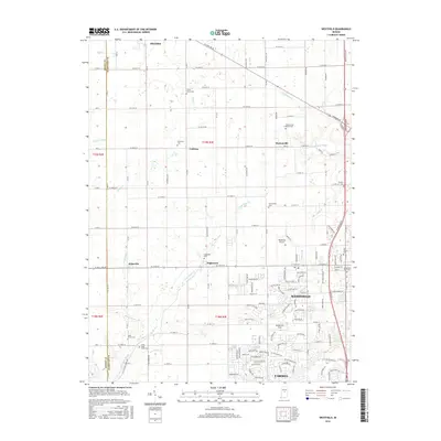
2016 Map of Westfield
USGS Topo · Published 2016About this map
Westfield and the northern reaches of Carmel anchor this modern survey of Hamilton County, showcasing a landscape where suburban expansion meets long-standing agricultural crossroads. The presence of the Anti-Slavery Cem near the intersection of W Main St and N Meridian St provides a significant genealogical touchstone, reflecting the region's historical social fabric. The map detail extends to established local settlements such as Eagletown, Jolietville, and Hortonville, each still serving as a distinct node in the rural grid.
Find a feature on this map
145 named features on this map. Tap any name to fly to it.
Don’t see what you’re looking for? This feature index may not catch every label — zoom into the map to look around manually.
Map Details
Editions of this 2016 Westfield Map
This is the sole edition of this map. No revisions or reprints were ever made.
Other maps of this area

1952 · Fishers
USGS Topo · 1:24,000

1952 · Carmel
USGS Topo · 1:24,000

1953 · Westfield
USGS Topo · 1:24,000

1953 · Rosston
USGS Topo · 1:24,000

1953 · Zionsville
USGS Topo · 1:24,000

1953 · Noblesville
USGS Topo · 1:24,000

1953 · Danville
USGS Topo · 1:250,000

1953 · Indianapolis
USGS Topo · 1:250,000

1955 · Danville
USGS Topo · 1:250,000

1956 · Danville
USGS Topo · 1:250,000