
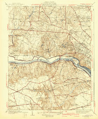
1942 Map of Westhampton
USGS Topo · Published 1942About this map
The James River corridor west of Richmond reveals a landscape of transition during the early 1940s, where older industrial relics meet emerging suburban development. Notable historical landmarks include the Bellona Arsenal (Ruins) and Hammack Mill along the riverbanks, contrasted by institutional growth at the University of Richmond and St Christopher Sch. The map documents a period before modern interstate expansion, showing the Midlothian Turnpike and Powhite Turnpike as primary arteries through rural terrain.
Find a feature on this map
70 named features on this map. Tap any name to fly to it.
Don’t see what you’re looking for? This feature index may not catch every label — zoom into the map to look around manually.
Map Details
Editions of this 1942 Westhampton Map
2 editions found
Other maps of this area

1890 · Goochland
USGS Topo · 1:125,000

1892 · Goochland
USGS Topo · 1:125,000

1894 · Bermuda Hundred
USGS Topo · 1:62,500

1894 · Richmond
USGS Topo · 1:62,500

1895 · Richmond
USGS Topo · 1:62,500

1897 · Amelia
USGS Topo · 1:125,000

1934 · Richmond
USGS Topo · 1:24,000

1936 · Richmond West
USGS Topo · 1:24,000

1936 · Glen Allen
USGS Topo · 1:24,000

1938 · Drewrys Bluff
USGS Topo · 1:24,000