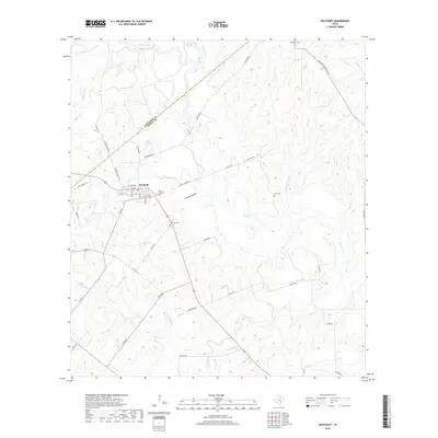
2019 Map of Westhoff
USGS Topo · Published 2019About this map
Westhoff is the primary settlement on this landscape, positioned where the southern Gonzales and DeWitt County line intersects the local road network. The town serves as a focal point for the surrounding ranching and farming communities, characterized by its grid of streets including Railroad St, Lane St, and Van Vleck Ave. This rural interior is marked by numerous family-associated sites and sacred spaces, notably Saint Aloysius Cem and Westhoff Cem located just outside the main cluster of homes.
Find a feature on this map
50 named features on this map. Tap any name to fly to it.
Don’t see what you’re looking for? This feature index may not catch every label — zoom into the map to look around manually.
Map Details
Editions of this 2019 Westhoff Map
This is the sole edition of this map. No revisions or reprints were ever made.
Other maps of this area

1920 · Smiley
USGS Topo · 1:125,000

1953 · Seguin
USGS Topo · 1:250,000

1958 · Seguin
USGS Topo · 1:250,000

1959 · Hochheim
USGS Topo · 1:24,000

1960 · Cuero
USGS Topo · 1:24,000

1960 · Concrete
USGS Topo · 1:24,000

1960 · Blackwell Lake
USGS Topo · 1:24,000

1960 · Cheapside
USGS Topo · 1:24,000

1960 · Westhoff
USGS Topo · 1:24,000

1961 · Sample
USGS Topo · 1:24,000