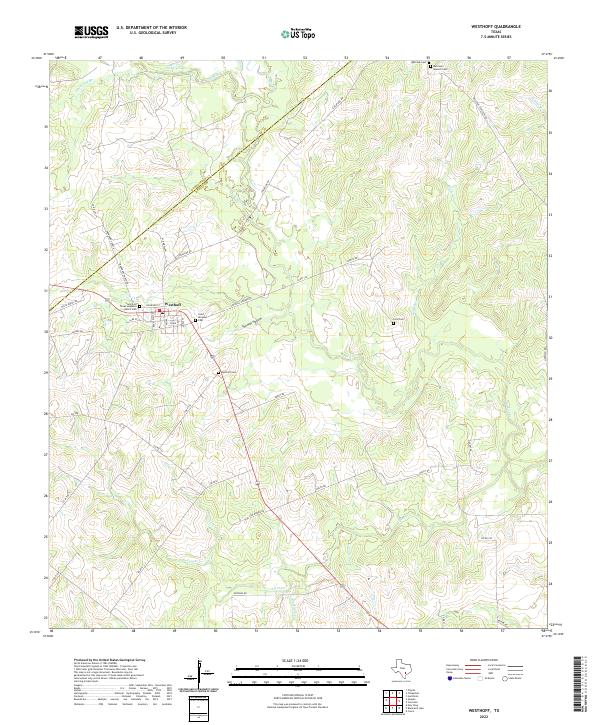
2022 Map of Westhoff
USGS Topo · Published 2022About this map
The community of Westhoff serves as the focal point for this rural South Texas landscape, situated along the county boundary between Gonzales Co and Dewitt Co. The layout of the town is defined by a grid of streets including Railroad St and Van Vleck Ave, reflecting a settlement pattern traditionally tied to transport corridors. Surrounding the town site, the terrain is deeply etched by a complex drainage network, most notably Sandies Cr and its various tributaries such as Birds Cr and Cooper Cr. These watercourses carve through the landscape to create features like Thomas Hollow. The area is notably dense with burial sites that provide a window into the local genealogy of the region, ranging from the Saint Aloysius Cem and Westhoff Cem near the town center to more remote locations like the Lord Cem and Bellview Spanish Cem.
Find a feature on this map
48 named features on this map. Tap any name to fly to it.
Don’t see what you’re looking for? This feature index may not catch every label — zoom into the map to look around manually.
Map Details
Editions of this 2022 Westhoff Map
This is the sole edition of this map. No revisions or reprints were ever made.
Other maps of this area

1920 · Smiley
USGS Topo · 1:125,000

1953 · Seguin
USGS Topo · 1:250,000

1958 · Seguin
USGS Topo · 1:250,000

1959 · Hochheim
USGS Topo · 1:24,000

1960 · Cuero
USGS Topo · 1:24,000

1960 · Concrete
USGS Topo · 1:24,000

1960 · Blackwell Lake
USGS Topo · 1:24,000

1960 · Cheapside
USGS Topo · 1:24,000

1960 · Westhoff
USGS Topo · 1:24,000

1961 · Sample
USGS Topo · 1:24,000