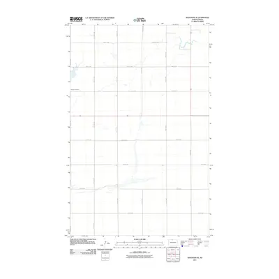
2011 Map of Westhope SE
USGS Topo · Published 2011About this map
The Week Cemetery stands as a quiet marker of local history in this rural landscape of Bottineau County. This 2011 survey reveals a vast, grid-based agricultural network defined by named section roads such as 19th Ave NW and 100th St NW. The terrain is characterized by prairie potholes and intermittent water bodies that dot the land between carefully partitioned fields. While modern in its data compilation from the U.S. Geological Survey, the map preserves the exact placement of family-named landmarks like the cemetery, offering a precise view of the rural township structure that has long defined the North Dakota plains.
Find a feature on this map
14 named features on this map. Tap any name to fly to it.
Don’t see what you’re looking for? This feature index may not catch every label — zoom into the map to look around manually.
Map Details
Editions of this 2011 Westhope SE Map
This is the sole edition of this map. No revisions or reprints were ever made.
Other maps of this area

1949 · Maxbass
USGS Topo · 1:24,000

1949 · Eckman
USGS Topo · 1:24,000

1949 · Landa
USGS Topo · 1:24,000

1949 · Westhope SW
USGS Topo · 1:24,000

1949 · Landa SW
USGS Topo · 1:24,000

1950 · Newburg
USGS Topo · 1:24,000

1950 · Westhope SW
USGS Topo · 1:24,000

1950 · Landa
USGS Topo · 1:24,000

1950 · Landa SW
USGS Topo · 1:24,000

1951 · Westhope SE
USGS Topo · 1:24,000